The project’s current focus is developing an independently monitoring approach for REDD+.
Objectives
- Strengthen DRC civil society and local communities to conduct indepedent forest monitoring, particularly REDD+ ;
- Conduct continuous and regular field monitoring in REDD+ project areas ;
- Increase civil society participation in monitoring REDD+ and broader natural resource issues.
About the Platform
How is Moabi built?
Our commitment to openness and independence also extends to how we are building Moabi DRC. The platform is built on a customized version of OpenStreetMap. OSM was built as an open source alternative to proprietary geographic data platforms, with voluntary contributions sourced from the crowd. Ten years later, and with over one million users, OSM provides both a model for how to collect, organize, and redistribute geographic data from disparate sources, as well as the technical tools to store and edit this data.
Using OSM as the basis for Moabi DRC has many advantages. Where appropriate, it allows data to be easily shared between OSM and Moabi, ensuring that data common to both – for instance on roads and buildings – is up-to-date. Moreover, by establishing a common data schema, it allows for easy read/write access to data from different sources, whether it relates to land use concessions, transportation networks, forest cover, or community reporting.
What can you do on Moabi DRC?
Explore the Data
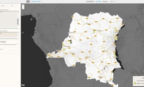
Browse extensive information on land use in the DRC via the interactive map. Export a map as a print copy, an embeddable url, or download the raw geographic data. If you would like to contribute your own data, This email address is being protected from spambots. You need JavaScript enabled to view it. and we will show you how to this.
View and publish Reports
Each presents specific data and analysis on a single topic. Browse reports to gain an in-depth understanding of the data, or build your own topic using your own data.
Open for Collaboration
Moabi is built on a clone of the OpenStreetMap project, an open, user-generated map of the world containing geographic data on buildings and navigation. Moabi extends OSM’s collaborative model to tackle difficult developmental problems relating to land use planning and natural resource management.
Who built Moabi DRC?
Moabi DRC is being built by a Washington DC-based startup called CrowdCover. CrowdCover was established by Moabi DRC founder and Project Leader, Leo Bottrill. The company has a dedicated team supporting Moabi DRC and plans to apply the Moabi platform to other transparency issues around the world. Please contact CrowdCover for more information.
Partners
- L’Observatoire Satellital des Forêts d’Afrique Centrale (OSFAC) OSFAC is a well established training center for GIS and remote sensing based in Kinshasa and will be responsible for the technical components of implementing MOABI in DRC, specifically for managing the GIS database. OSFAC was established in 2000 to support the management of natural resources by producing reliable land cover products, distributing satellite data, building capacity and providing technical assistance to implementing partners.
- Observatory of Forest Governance (OGF) OGF is an independent forest monitoring NGO operating in the Democratic Republic of Congo. OGF, was founded by British NGO called Resource Extraction Monitoring (REM) who transferred all of their DRC operations to OGF. The primary aim of OGF is to develop and conduct monitoring activities on forest management and exploitation in DRC. They are a mandated Independent Observer for FLEG DRC and have conducted monitoring missions in partnership with the World Bank and FAO.
- Institute for Applied Systems Analysis (IIASA) The International Institute for Applied Systems Analysis is a scientific research institute located in Laxenburg, near Vienna, Austria. Founded in 1972, IIASA conducts policy-oriented research into problems of a global nature that are too large or too complex to be solved by a single country or academic discipline. IIASA is sponsored by its National Member Organizations in Africa, Asia, Europe, and the Americas. Its research is independent and completely unconstrained by political or national self-interest.
Acknowledgements
Moabi DRC would not have made possible for the support of a many collaborators. In particular we would like to thank the following people and organizations who have supported and advocated for the initiative:
Bruno Hugel, Bruno Perodeau, Landing Mane, Lars Ekman, Leslie Ouazazi, Raymond Lumbuenamo, Ed Hastings and OHO Interactive, Charles Huang, Adam Dixon, Bruno Guay, Colby Loucks, Michael Obersteiner, Ben Mahler, Tim ‘Chippy’ Waters, Owen Cylke, David Reed, Florence Bwebwe, Ingrid Timboe, and Catherine Bottrill.


