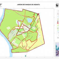
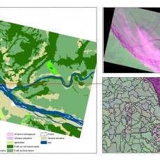
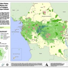
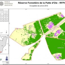
OSFAC-DMT Desktop allows you to view and manipulate spatial data easily and an intuitive manner. It allows you to view but also edit, save and analyze spatial data. It handles vector data but also allows to read Raster. "It should be noted that this tool does not allow you to download satellite images".
This software was developed in Java (JDK 1.7) and works with a MySQL database, the geographical part is based on JUMP Pilot Project as a platform. OSFAC-DMT Desktop is available in 2 versions:
- OSFAC-DMT Desktop Lite (98 MB) downloadable here ;
- OSFAC-DMT Desktop Full : Available only for OSFAC team.
How to apply for satellite imagery via geographic search interface
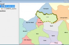
Search option of satellite imagery can be accessed via the toolbar by clicking "Search Images". It is only active when features are selected using the selection tool. This option allows user to search satellite images that intersect the selected features in the database provided with the application, and display the result in a new window. In the following example, it comes to find all satellite images that intersect "Luila" area. Features to be Selected to search satellite images can be :
- A feature of an existing layer ;
- A feature designed (point, line or polygon) using the editing tools ;
- A geometric object from a WKT file (Well Known Text).
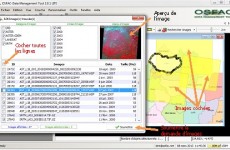
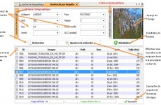
Once the selection is made, "Search Images" button will start to search and display the result in a new window. Number of images found is displayed on the title bar of the window, for this example (Luila), 473 images have been displayed. This number represents total of images found concerning all categories available in the database. Categories of images to search can be filtered via the menu button "Search Images", it contains: ASTER, ASTER GDEM, LANDSAT, LANDSAT MOSAIC, SPOT and SRTM. List "category of images" shows the different types of images and these categories can be filter by deselecting one or more categories. "All" selects all categories available and the same way for the list of "Year of images." Each click on the table row represents an image (ID, image Name, date and size). By clicking on an image, the application will search on OSFAC's website (www.osfac.net) the quicklook of the image and displays it. Double-click on a table row or on the quicklook at the top of the window expands its display on a larger window. Once the selection of images to submit duly done by clicking on the checkboxes of table rows, the "Submit" button validates the satellite images request form to be fill out.
How to apply for satellite imagery via query search interface
Among the objectives of creating OSFAC-DMT is found the facilitation to make and manage requests of satellite images remotely. Hence the creation of the search interface that is easy and intuitive for quick search of satellite images in the database. This tool is available via the menu "Tools > query Search" or by just clicking on the button on the toolbar OSFAC-DMT. The idea of this search is to construct a query of images by selecting one or more criteria available. There are 2 types of criteria: The main criteria and geographic criteria.
Main criteria
The interface "Main criteria" refers to the different features of an image directly. This group of criteria concerns largely Landsat images. These criteria are: Category, Path, Row, Year, Country, Mission, Ortho rectified, SLC (For Landsat images only).
Geographic criteria
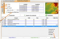
The interface "Geographic criteria" allows you to define search criteria based on geometry which can be: point, line or polygon. Coordinate of your area of interest must be geographic. User has the ability to import different values of Latitude and Longitude using an Excel file. The combination of main and geographic criteria is not prohibited. It is not mandatory to select all criteria, one or two may be sufficient to search for images. But it should be noted that lots of search criterias takes less time, but less criteria, the execution of the search takes long time. Before starting to display images, the application performs a simulation to estimate the execution time. If the result of a request has more than 2000 images to be displayed, the application displays a dialog box warning you that it will take a few minutes to run. Cancelling a search request is still active. "Search" button allows you to start a new search images while crushing the result of a previous search and displays the result of the latter in the table. "Add to Search" can search images while preserving the results of previous search, and "Submit" button to validate satellite images request displaying a form to be filled out Each row of the table displays represents an image (ID, name of the image, Path, Row, date and size) by clicking on it, the application search on the OSFAC website (www.osfac.net) the quicklook of the image and displays it.


