Remote Sensing Level I
Remote Sensing
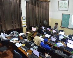
The objective of the training is to provide the learner with the essential knowledge base and to familiarize the key concepts used in remote sensing. It is aimed at people with no special knowledge in remote sensing but with notions Geomatics GIS or better and want to learn the tools of remote sensing. Rich in theory and practice, this course focuses on examples and demonstrations.
Content
- Introduction to Remote Sensing
- Active and passive remote sensing
- ERDAS / ENVI Menu Toolbar
- Opening and viewing an image
- Import generic formats of images
- Combination of bands
- Colored composition
- Make a mosaic
- Band Math (Math Bands)
- Creation of training areas (AOI)
- Cutting a picture
- Ortho-rectification of Image and Geo-referencing
- Resampling or interpolation of the pixel values
- Image Enhancement
- Classifications supervised and unsupervised
- Notions of vegetation indices (NDVI, for example)
Prerequisite: Knowledge of basic concepts of GIS and minimal comfort in the Windows environment.
- Reference Nr.:
- RS001
- Experience Level:
- Beginner
- Group:
- Default Group


