Botanical garden of Kinshasa
Project description
Main objective
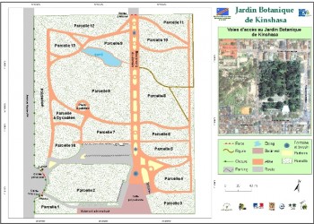
- Develop a geographic database of Botanical Garden of Kinshasa
Specific objectives
- Geolocate trees of the Garden
- Achieve Garden Map
- Jardin bot Kinshasa
Methodology
- GPS surveying and measuring distances on land
- Processing and data encoding
- Production of a general map of the Garden
Partners
- Botanical Garden of Kinshasa, MECNT, IJBZ, OSFAC
- Embassy of France
- Commune de la Gombe - Kinshasa (DRC)
Duration : 1 Month
Results
- General map of the Garden made
- Database of Garden created
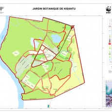
Botanical garden of Kisantu
Project description
Main objective
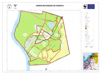
- Develop a geographic database of Botanical Garden of Kisantu
Specific objectives
- Update data of the botanical garden
- Collect GPS data on the field
- Achieve a detailed mapping of the Garden
Methodology
- GPS points taken on field
- Processing and typing information
- Production of a general map of the Garden
Partners
- Botanical Garden of Kisantu / National Botanic Garden of Belgium
Duration : 1 Month
Results
- General map of Botanical Garden made
- Database of Garden created
- Thematic Maps
University of Kinshasa
Project description
Main objective
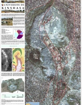
- Produce the general map of the University of Kinshasa (UNIKIN)
Specific objectives
- Involve students in the realization of the map
- Show the role of OSFAC in university training in GIS and Remote Sensing
Methodology
- GPS data collection on the field
- Digitization background IKONOS images
- Production of the general map of UNIKIN
Partners
- Faculty of Agricultural Sciences / UNIKIN, OSFAC
Duration : 1 Month
Results
- Map of UNIKIN made
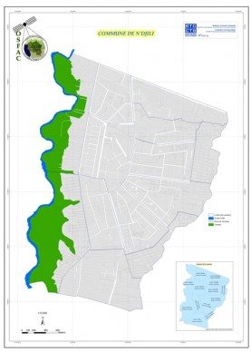
Municipality of N’djili
Project description
Main objective
- Develop a spatial database of N'djili
Specific objectives
- Achieve a detailed mapping of N'djili
- Collect GPS data on useful infrastructure for the development of N'djili
Methodology
- Discussion with the Authority and the Heads of municipal district of the preliminary delineation of the areas
- Production of a draft of the general map
- Production of maps by area
- GPS points taken on field
- Processing and typing the information collected
- Production of a final general map of N'djili and neighborhoods
Partners
- Coopération Technique Belge (BTC-CTB) / PAIDECO
Duration : 12 Months
Results
- General map of the Municipality of N'djili
- Maps of areas
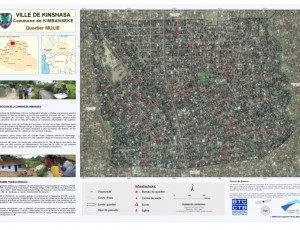
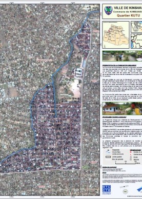
Municipality of Kimbanseke
Project description
Main objective
- Develop a spatial database of Kimbanseke
Specific objectives
- Achieve a detailed mapping of Kimbanseke
- Collect GPS data on useful infrastructure for the development of Kimbanseke
Methodology
- Discussion with the Authority and the Heads of municipal district of the preliminary delineation of Kimbanseke
- Production of a draft of the general map
- Production of maps by area
- GPS points taken on field
- Processing and typing the information collected
- Production of a final general map of Kimbanseke and neighborhoods
Partners
- Coopération Technique Belge (BTC-CTB) / PAIDECO
Duration : 12 Months
Results
- General map of the Municipality of Kimbanseke
- Maps of areas
Aménagement du Territoire
- Nov 20 2014
Botanical garden of Kinshasa, Botanical garden of Kisantu, University of Kinshasa, Municipality of N’djili and Municipality of Kimbanseke.
0


